regriding
Added by kunal bali over 7 years ago
Dear Users,
I have data file with gridtype = generic
#- gridID 0
#
gridtype = generic
gridsize = 1440000
xname = x
xunits = degrees
yname = y
yunits = degrees
xsize = 1200
ysize = 1200
The data is curvilinear grid structure. cdo is reading the file, but not able to extracting the data. So I changed the gridtype = generic to gridtype= lonlat via
cdo remapbil maiactaotE.h00v02.20010040635-20011550640.nc regrid.nc
#- gridID 0
#
gridtype = lonlat
gridsize = 1440000
xname = longitude
xlongname = longitude
xunits = degrees
yname = latitude
ylongname = latitude
yunits = degrees
xsize = 1200
ysize = 1200
xfirst = 64.23634233372,76.8178669755364,79.4747290253718,68.0771493550491
xinc = 0.01
yfirst = 32.0383879015429,34.9985549202943,24.5580030404694,21.8673735745303
yinc = -0.01
Now CDO can extract the data. But now the problem is that grid structure has shifted its position and shape.
So please let me know how to change gridtype to lonlat without changing the position of the grid structure
Replies (1)
RE: regriding - Added by Karin Meier-Fleischer over 7 years ago
Hi Kunal,
ncdump shows that the coordinates variables are missing in your data file:
ncdump -h maiactaotE.h00v02.20010040635-20011550640.nc
netcdf maiactaotE.h00v02.20010040635-20011550640 {
dimensions:
time = UNLIMITED ; // (3 currently)
YDim_grid1km = 1200 ;
XDim_grid1km = 1200 ;
variables:
double time(time) ;
time:units = "hours since 2000-01-01 00:00:00" ;
time:calendar = "standard" ;
double lat(YDim_grid1km, XDim_grid1km) ;
lat:projection = "Albers Conical Equal_Area" ;
lat:corners = 32.0383879015429, 34.9985549202943, 24.5580030404694, 21.8673735745303 ;
lat:long_name = "latitude" ;
lat:units = "degrees_north" ;
double lon(YDim_grid1km, XDim_grid1km) ;
lon:projection = "Albers Conical Equal_Area" ;
lon:corners = 64.23634233372, 76.8178669755364, 79.4747290253718, 68.0771493550491 ;
lon:long_name = "longitude" ;
lon:units = "degrees_east" ;
short Optical_Depth_055_grid1km(time, YDim_grid1km, XDim_grid1km) ;
Optical_Depth_055_grid1km:coordinates = "GridLat_grid1km, GridLon_grid1km" ;
Optical_Depth_055_grid1km:hdfeos_name = "Optical_Depth_055" ;
Optical_Depth_055_grid1km:projection = "Albers Conical Equal_Area" ;
Optical_Depth_055_grid1km:valid_range = -100s, 5000s ;
Optical_Depth_055_grid1km:_FillValue = -28672s ;
Optical_Depth_055_grid1km:unit = "None" ;
Optical_Depth_055_grid1km:add_offset = 0. ;
Optical_Depth_055_grid1km:scale_factor = 0.001 ;
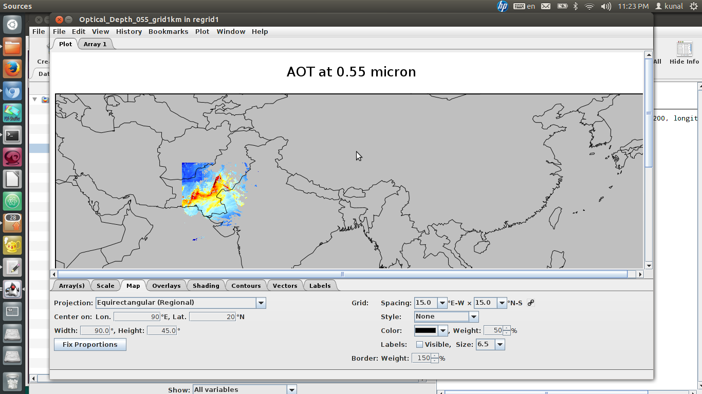
Optical_Depth_055_grid1km:long_name = "AOT at 0.55 micron" ;
// global attributes:
:creation_date = "Mon Nov 6 18:39:38 IST 2017" ;
:Conventions = "None" ;
:NCL_version = "Any version of NCL >= 5.2.0 (4/2010)" ;
:source_file = "MAIACTAOT HDF-EOS files" ;
:title = "MAIACTAOT HDF-EOS: time dimension added to selected variables" ;
:history = "Mon Nov 6 22:53:15 2017: ncatted -a coordinates,Optical_Depth_055_grid1km,c,c,lon lat maiactaotE.h00v02.20010040635-20011550640.nc" ;
:NCO = "4.6.7" ;
}
GridLat_grid1km, GridLon_grid1km is missing in the file.
If I set the coordinates to the included lat and lon variables:
ncatted -O -a coordinates,Optical_Depth_055_grid1km,o,c,"lat lon" $infile tmp.nc
and remap the data using the following grid file:
gridfile.txt:

gridtype  = lonlat
gridsize  = 1440000
xsize     = 1200
ysize     = 1200
xname     = lon
xlongname = "longitude"
xunits    = "degrees_east"
yname     = lat
ylongname = "latitude"
yunits    = "degrees_north"
xfirst    = 60.0
xinc      = 0.02
yfirst    = 18.0
yinc      = 0.02
cdo remapbil,gridfile.txt tmp.nc result.nc
This will take some time but you can make it faster using the -P option.
-Karin