remapcon
Added by Ronnie Abolafia-Rosenzweig about 7 years ago
Hello,
I would like to use conservative remapping to bring data in the MOD16A2_ET_0.5deg_GEO_2007M06.nc file to the same lat-lon grid in Half_degree_chirp.1993.09.nc. The issue is that after remapping, the out_file reports values that are approximately half that of the in_file.
First, I am using the following command to assign units to 'lat' and 'lon' variables in MOD16A2_ET_0.5deg_GEO_2007M06.nc to avoid an "unsupported generic grid!"
ncatted -a units,lon,o,c,'degreeE' -a units,lat,o,c,'degreeN' MOD16A2_ET_0.5deg_GEO_2007M06.nc
Next I perform remapping with the following command:
cdo gencon,prcp_monthly_1901-2012.nc MOD16A2_ET_0.5deg_GEO_2007M06.nc Weights.nc
cdo remap,prcp_monthly_1901-2012.nc,Weights.nc MOD16A2_ET_0.5deg_GEO_2007M06.nc MOD16A2_ET_0.5deg_GEO_200706.nc
where,
target_grid=Half_degree_chirp.1993.09.nc
in_file=MOD16A2_ET_0.5deg_GEO_2007M06.nc
out_file=MOD16A2_ET_0.5deg_GEO_200706.nc
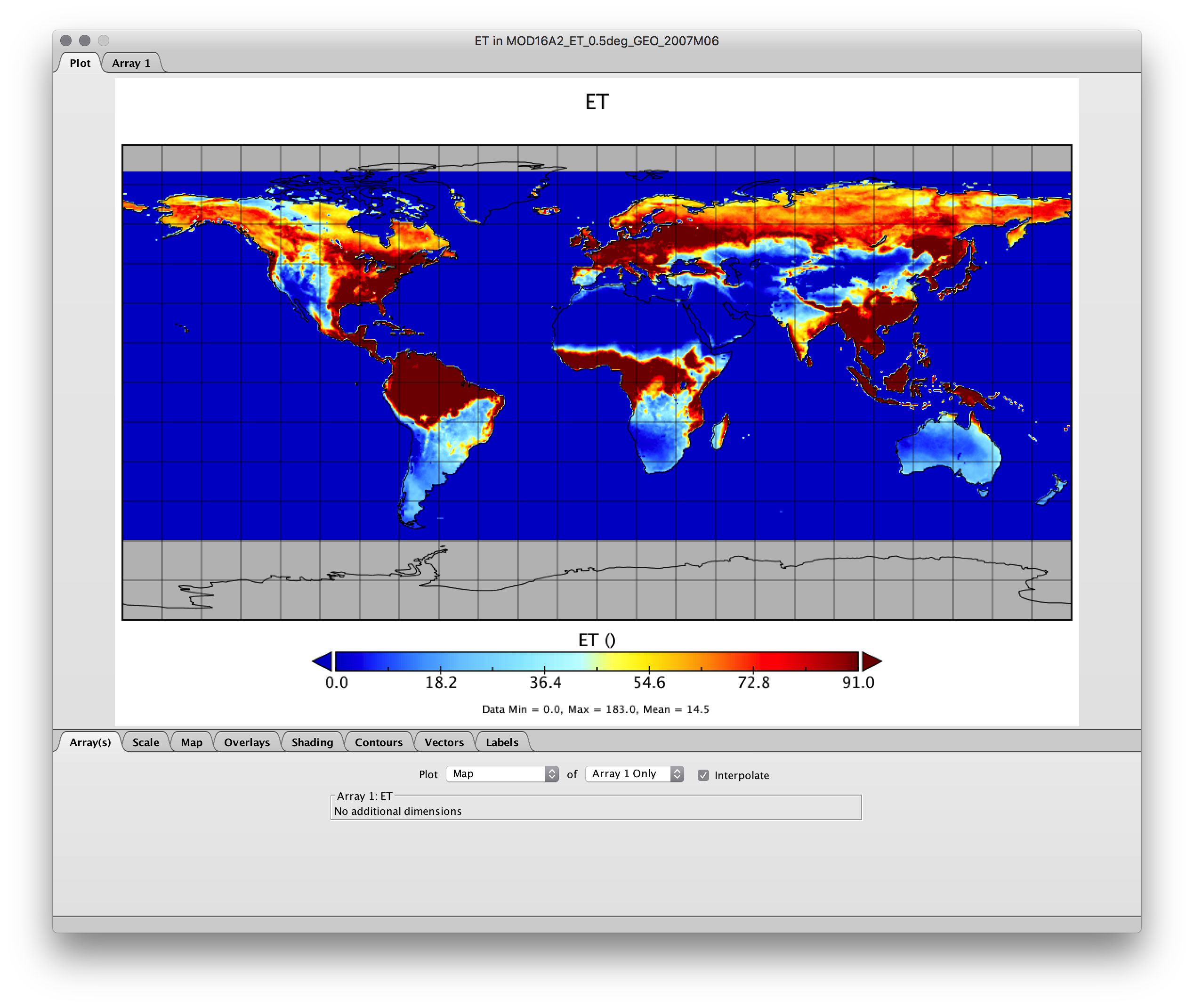
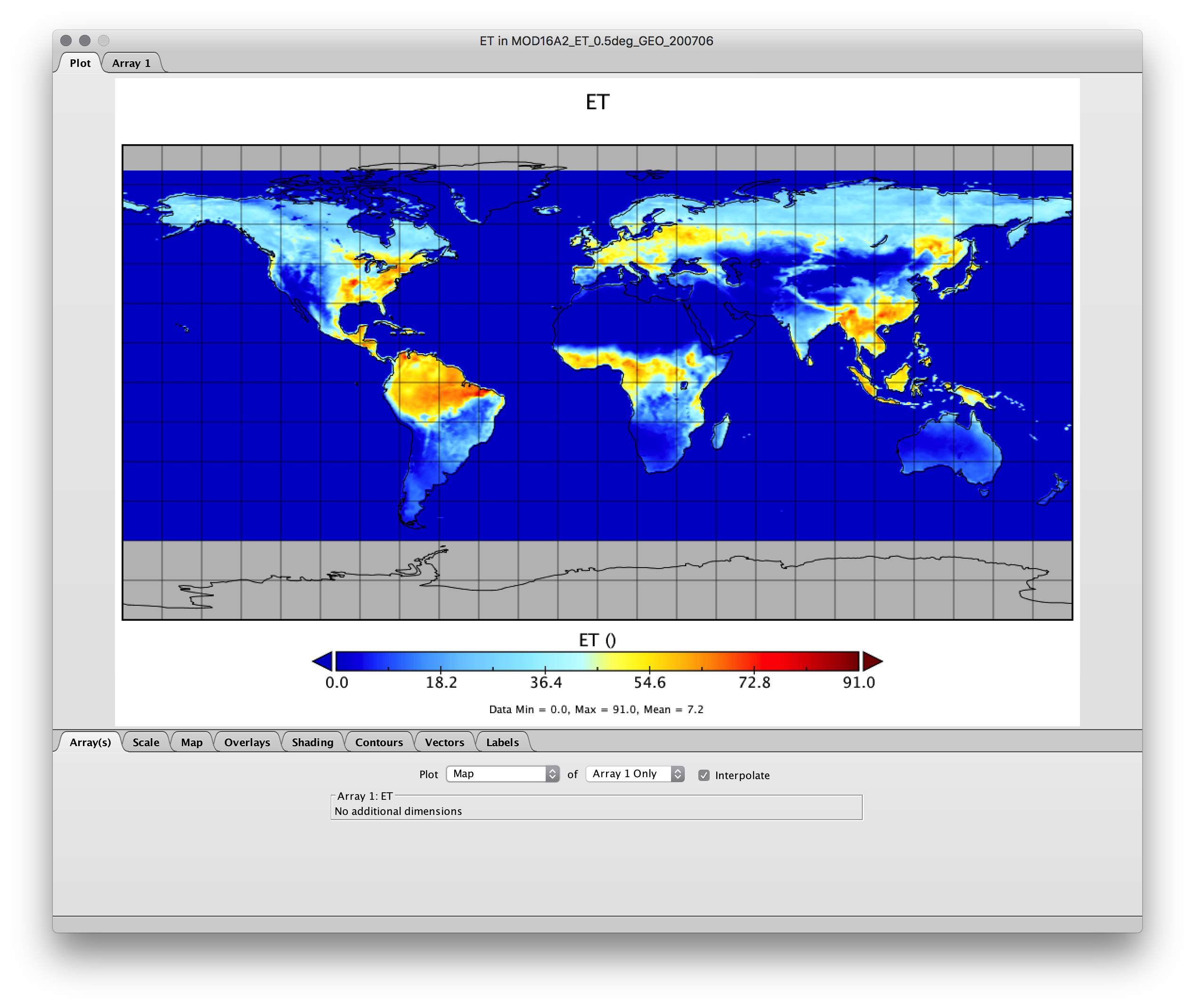
The remapping is performed, but the 'ET' values in the out_file are approximately half that of in_file. I calculated the total sum for the 'ET' variable in both files and the mean of the 'ET' variable in both files. Both the sum and the mean support the out_file's 'ET' is about half that of the in_file's 'ET'. in_file and out_file are on different 0.5-degree grids. I do not believe this issue (halving of 'ET' values) should be occurring. Is this an issue with the commands I am using?
Replies (1)
RE: remapcon - Added by Ronnie Abolafia-Rosenzweig about 7 years ago
For clarification I have included spatial plots of the 'ET' variable before and after remapping to show the reduction in values. I have also confirmed that similar results occur when using other remap techniques, e.g. remapbil.
Original is the spatial plot of the in_file (MOD16A2_ET_0.5deg_GEO_2007M06.nc)
Remapped is the spatial plot of the out_file (MOD16A2_ET_0.5deg_GEO_200706.nc)
| Original.png (528 KB) Original.png | |||
| Remapped.png (546 KB) Remapped.png |