Transformation from lat-lon to LCC
Added by John Martinez over 11 years ago
Hi,
I'm trying to interpolate some data from a lat-lon projection to a Lambert Conformal Conic (lcc) projection. I'm using the command:
cdo -f grb remapbil,gridSAlcc3.txt -setgrid,grideraiNorthInv.txt erai_geoYlandsea_SA_inv.grib erai_geoYlandsea_SA_lcc.grib
where gridSAlcc3.txt is:
#- gridID 0
#
gridtype = lcc
gridsize = 7990
xsize = 85
ysize = 94
originLon = -90.0
originLat = 0.0
lonParY = -60
lat1 = 5
lat2 = 42
xinc = 91202.7
yinc = 91202.7
projection = north
and grideraiNorthInv.txt is:
#- gridID 0
#
gridtype = lonlat
gridsize = 7938
xname = longitude
xlongname = longitude
xunits = degrees_east
yname = latitude
ylongname = latitude
yunits = degrees_north
xsize = 81
ysize = 98
xfirst = -90
xinc = 0.75
yfirst = -57.75
yinc = 0.75
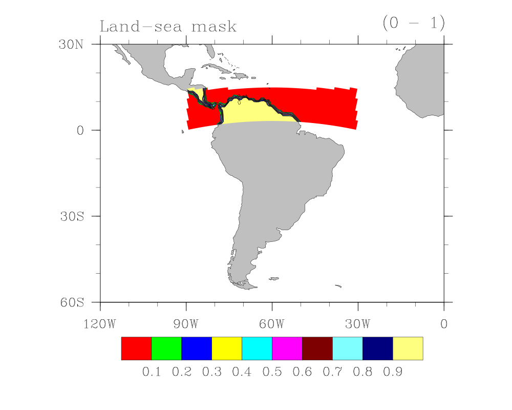
My input data covers latitudes on both hemispheres. My problem is that the output file only contains data for the northern hemisphere: all the data south of the equator is lost. I also tried by setting "projection = southpole" for the target grid, but the result is the same as before.
How can I get the right transformation? I'm attaching my working files. I will appreciate any comments on this issue.
Best regards,
John
| erai_geoYlandsea_SA_inv.grib (31.2 KB) erai_geoYlandsea_SA_inv.grib | Input data in lat-lon projection | ||
| erai_geoYlandsea_SA_lcc.grib (6.61 KB) erai_geoYlandsea_SA_lcc.grib | Output file from remapbil | ||
| gridSAlcc3.txt (218 Bytes) gridSAlcc3.txt | Target grid, Lambert Conformal Conic | ||
| grideraiNorthInv.txt (287 Bytes) grideraiNorthInv.txt | Source grid, lat-lon | ||
| erai_SA_lcc_lsm.000001.png (69.2 KB) erai_SA_lcc_lsm.000001.png | Plot of results |